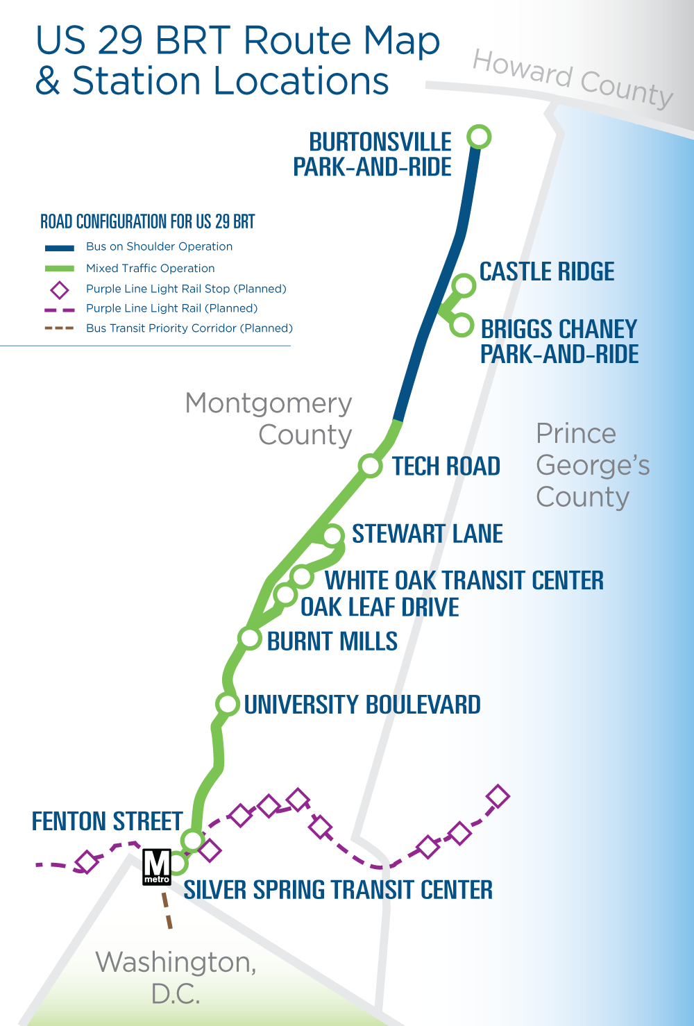
The maps below compare the county’s current BRT plan with the Better BRT plan.
County’s current plan map
The county’s current plan proposes dedicated lanes on the shoulder from Burtonsville almost to Tech Road (approximately 40% of the Route 29 corridor).

Better BRT plan overview map
Better BRT would extend the dedicated bus lanes from where they are planned to end in the county’s current plan (north of Tech Road) to over four miles south down to Sligo Creek Parkway. An optional component of the Better BRT plan could extend the dedicated lanes further south, to Georgia Avenue by repurposing a general traffic lane.
Use the slider on the map below to compare the extent of dedicated lanes in the current plan versus the Better BRT plan.


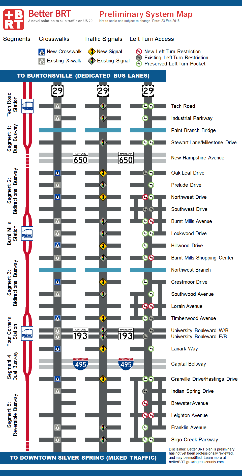
Better BRT plan detailed map
The Better BRT plan will build on the county’s current plan by extending dedicated bus lanes from Tech Road to Sligo Creek Parkway, approximately 1 mile north of the Silver Spring Metro Center.
The map below also shows locations of existing and new crosswalks, traffic signals, and turn restrictions under the Better BRT plan. Each column in the figure below represents a different feature of the Better BRT plan.
